
A sharp-eyed Earth-observing satellite has shared an updated view of the world’s largest iceberg, which remains stuck just offshore of a remote island in the South Atlantic.
The drifting Antarctic iceberg A-23A came to a sudden stop in late February off the coast of South Georgia Island — a British overseas territory in the South Atlantic Ocean and the largest of nine islands that make up the South Georgia and South Sandwich Islands.
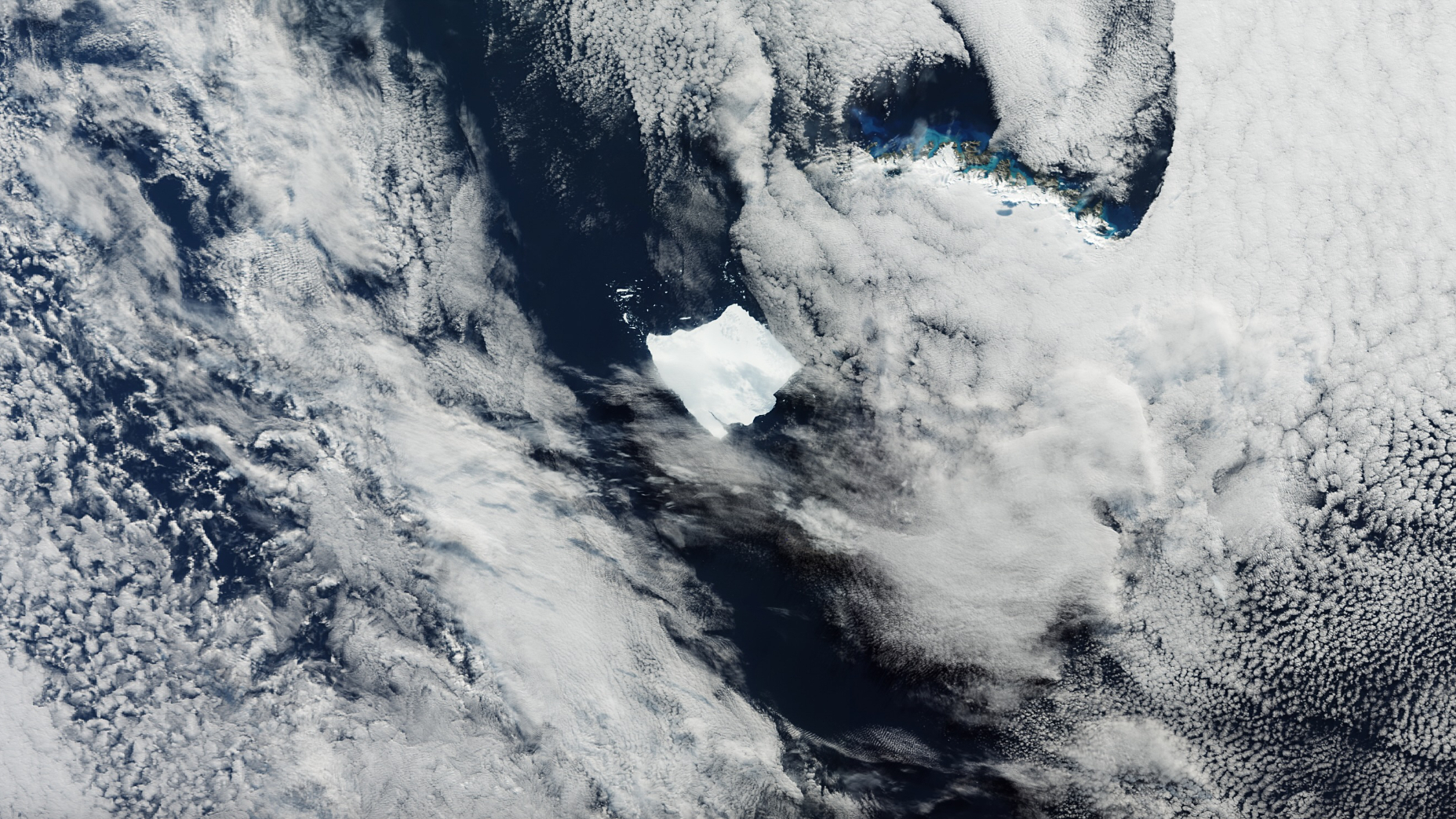
Measuring 1,240 square miles (3,460 square kilometers), A-23a is twice the size of Greater London and nearly the same size as the entire South Georgia island, which is only 1,362 square miles (3,528 square km). The massive iceberg is believed to be snagged on a shallow underwater shelf off the coast of the island, according to a statement from the European Space Agency (ESA).
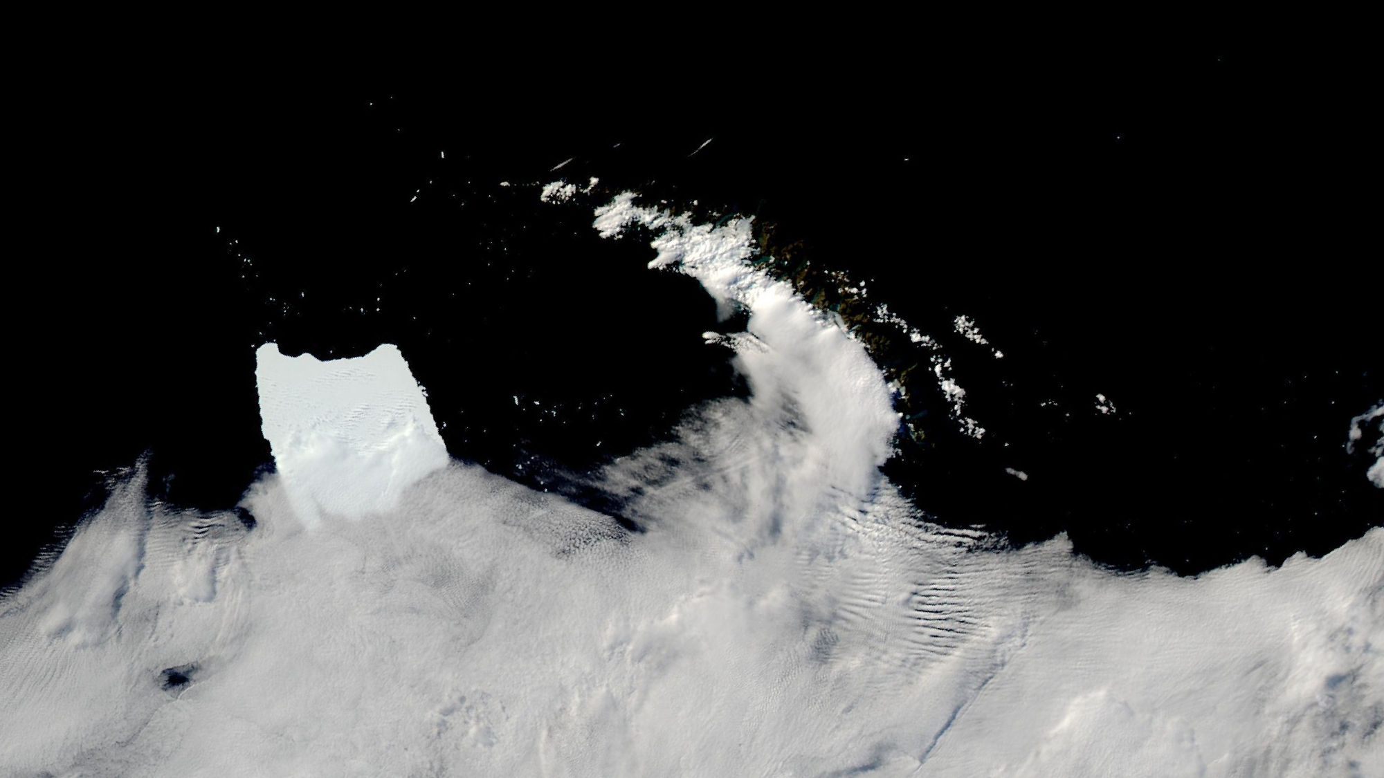
The Ocean and Land Colour Instrument on ESA’s Copernicus Sentinel-3 satellite captured a new image of A-23a on April 5, showing the unmoving iceberg 45 miles (73 km) from the remote island, parts of which can be seen beneath thick cloud cover.
A-23A has traveled more than 1,200 miles (2,000 km) north from its home in the Southern Weddell Sea, where it calved from Antarctica's Filchner-Ronne Ice Shelf in 1986. In the early 2020s, the iceberg broke away from the seafloor and began to drift. Since stranding near South Georgia Island, several small blocks of ice have fallen off A-23A and can be seen floating in the dark blue ocean, just north of the iceberg in the new satellite image.

"The disintegration is typical of icebergs that reach this far north and is caused by the warmer sea temperatures and weather conditions," ESA officials said in the statement.
Satellites will continue to monitor the iceberg’s activity and disintegration, as this introduces fresh water that could affect the island's biodiversity.


 English (US) ·